
Features
Features
Where to plant what, how many, and how. The tedious thinking behind an orchard, sorted out on one screen.
01
Orchard Layout
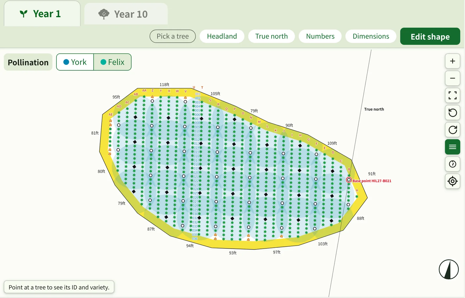
Build a planting layout from the shape, orientation, spacing and block conditions of your site.
- Draw the shape of your land and edit it later
- Draw exclusion zones where trees will not be planted, such as slopes
- Choose a buffer around the site and the row direction (true north, magnetic north or a set angle)
02
Pollination Balance
See where producer trees and pollinizers are, how far pollen reaches, and where it falls short.
- Pollinizer points are calculated from variety compatibility (recommended / not in the table / does not pollinate)
- Trees with too few points inside the pollen reach are shown by color and in a list
- Compare the pollinizer share in year 1 and year 10
03
Spacing & Counts
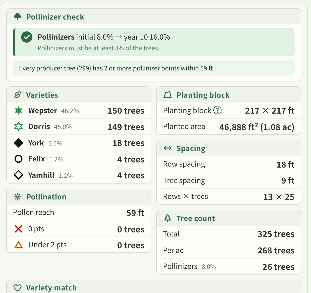
Check tree counts, density and the resulting layout from row spacing, tree spacing and block size.
- Pick row and tree spacing and the counts and trees per acre change
- Compare year 1 (nursery trees) with year 10 after thinning
- See the count for each variety
04
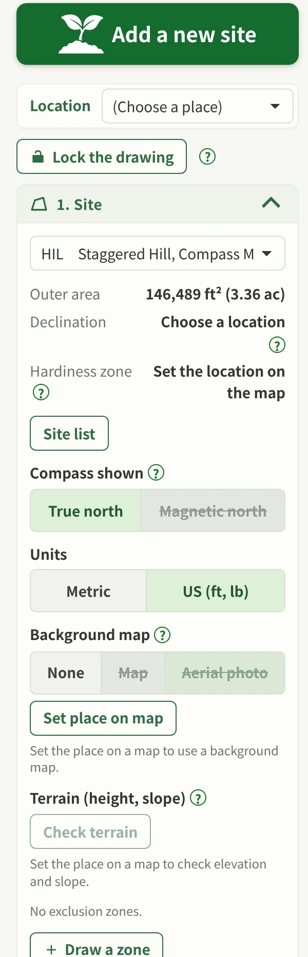
Map-based Planning
Plan with the real shape of your land, taking orientation, slope and exclusion zones into account.
- Set the place on the map to put a map or aerial photo behind your site
- Work with true north, magnetic north (declination) and base point coordinates
- Check terrain (elevation and slope) and mark steep slopes as exclusion zones
05
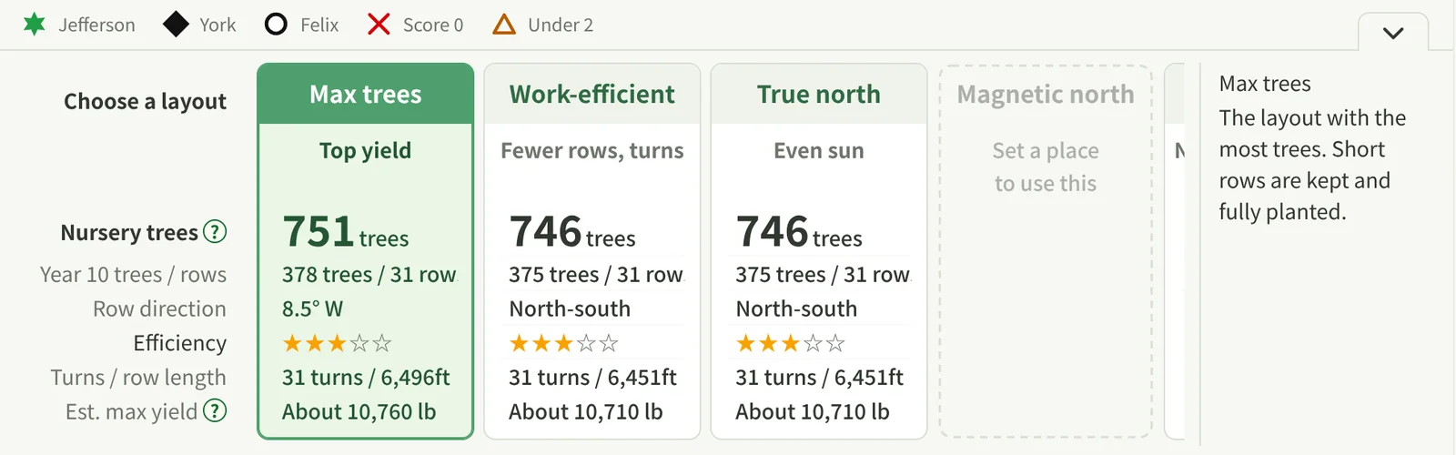
Plan Comparison
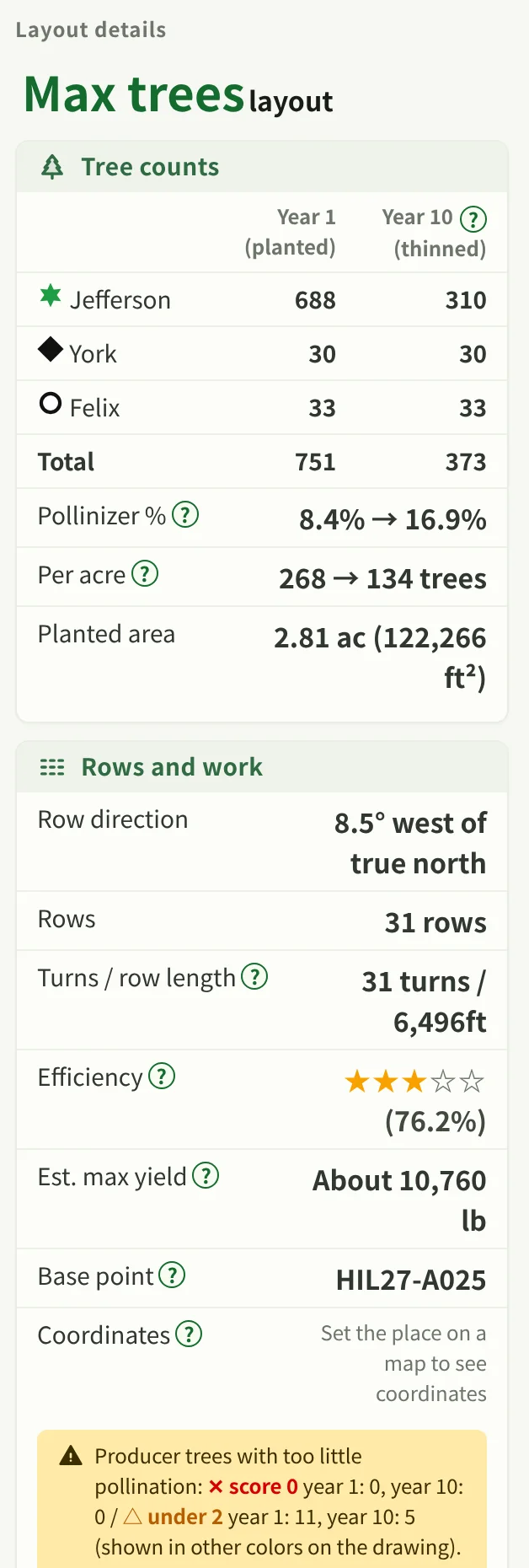
Compare several layout plans on the measures the tool actually shows: counts, workability, direction and more.
- Put plans such as Max trees, Work-efficient and True north side by side
- Compare nursery trees, rows, turns and estimated maximum yield
- Yield figures are estimates, meant as a guide
06
Export & Share
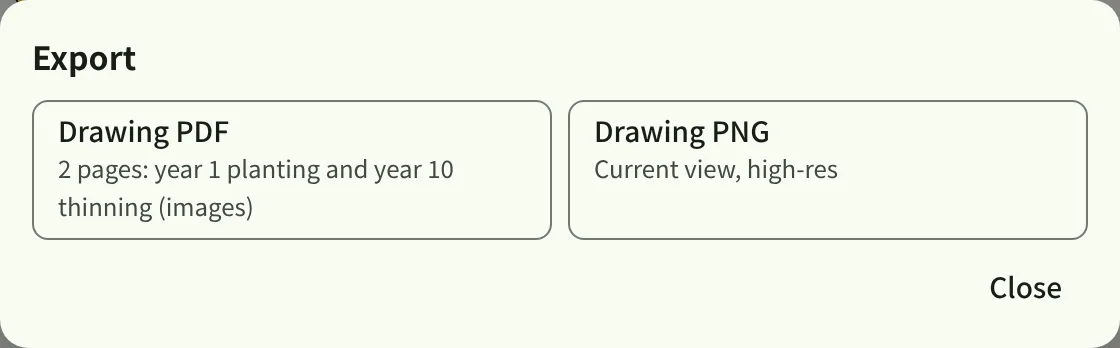
Export your finished plan in the formats the tool supports, for checking in the field and sharing.
- Drawing PDF: two pages, planting in year 1 and thinning in year 10
- Drawing PNG: the current view in high resolution
- Use Backup to save your stored data to a file
TWO PLANNING MODES
Two planning modes
Use whichever fits your goal. Neither is better than the other.
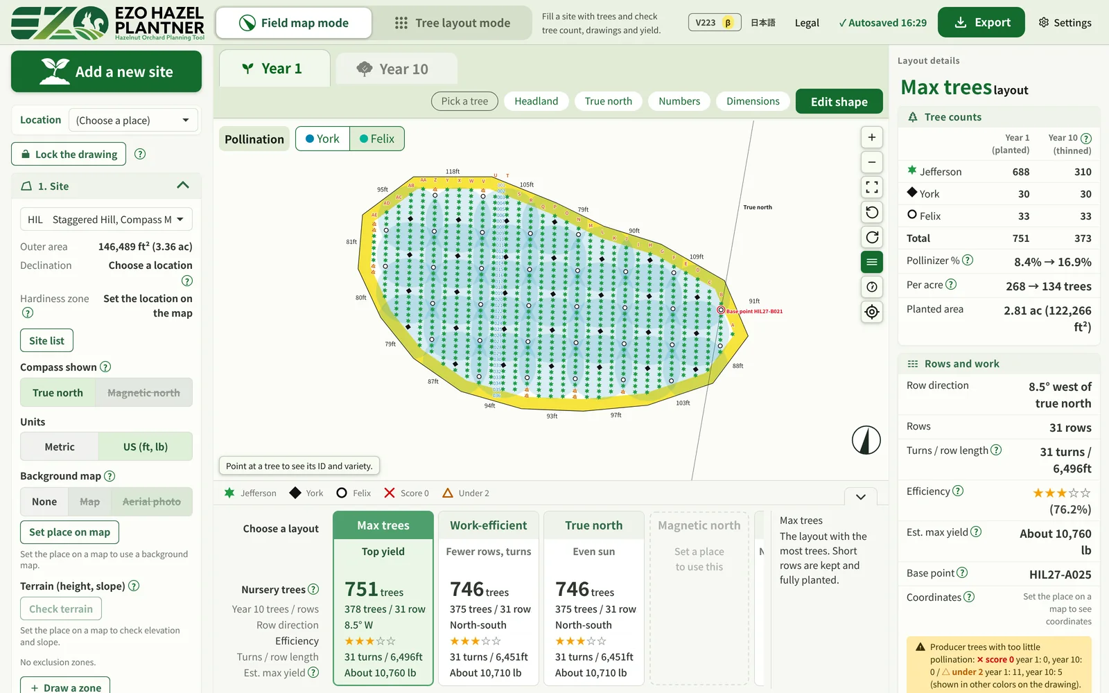
Field map mode
Plan from the real conditions of a site. It handles slope, exclusion zones and orientation.
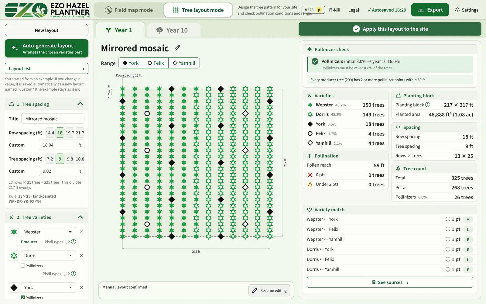
Tree layout mode
Work out how to arrange trees from block, spacing, varieties and pollination conditions, and check pollination and counts.
START PLANNING YOUR ORCHARD
Start your orchard plan
Choose your land and your varieties, then try making a layout.